Neighbourhood Map
Discover your new neighbourhood. These streets give you access to the best
of Oshawa’s dining, shopping, artistic expression, recreation and wellness.
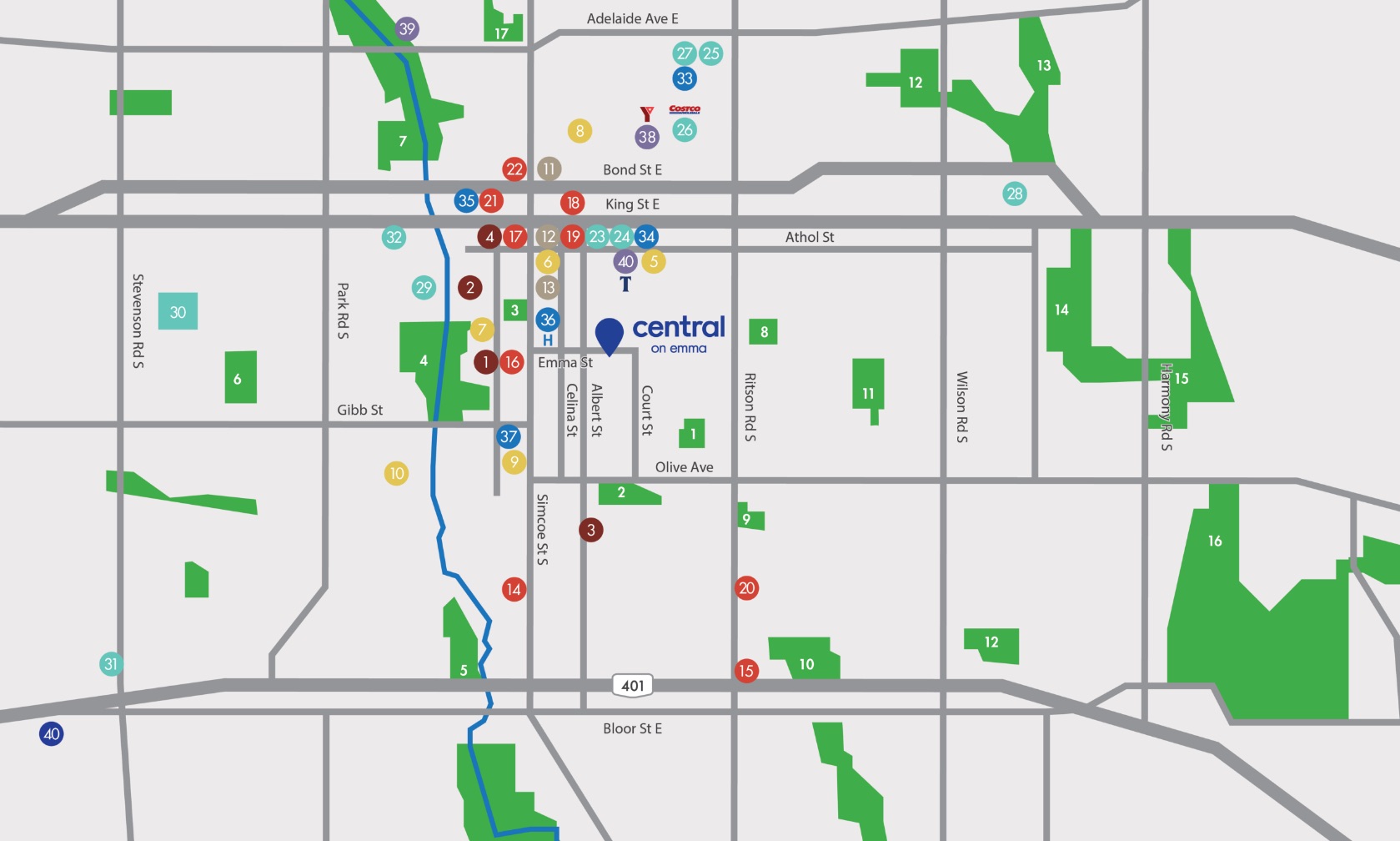
Cultural Venues
- Terry’s Pet Portraits
- The Robert McLaughlin Gallery
- Hungarian Culture Club
- Scuba Ontario Club
Schools
- U of T Institute of Technology
- Ummati School
- E.A. Lovell School
- Mary Street Community School
- Durham Alternative Secondary School
- Village Union Public School
Historical Landmarks
- RS McLaughlin Armoury
- The Algiers Building
- Canadian Automotive Museum
Restaurant & Bar
- Wood N Grill
- Cyrus Persian Restaurant
- City Patties
- Cork & bean
- Kenzo Ramen
- General Pub and Grill
- All or Nothing Brewhouse & Distillery
- The White Apron Restaurant
- Rainbow Restaurant
- Atria Bar & Grill
- Riley’s Pub
Shopping & Grocery
- NoFrills
- Costco
- Bulk Barn
- Fresh Co.
- The Beer Store
- Oshawa Centre
- SmartCentres Oshawa South
- Shoppers Drug Mart
Hospitals & Clinics
- Oshawa Eye Health Clinic
- Oshawa Clinic
- CMHA Durham
- Lakeridge Health CEPCP Training
- Glazier Medical Centre
Recreation
- YMCA
- Oshawa Golf & Curling Club
- Tribute Communities Centre
Transit
Parks
- Sunnyside Park
- Cowan Park
- Memorial Park
- Rotary Park
- Storie Park
- Radio Park
- Valleyview Gardens
- Bathe Park
- Mitchell Park
- Chopin Park
- Eastview Park
- Woodview Park
- Eastbourne Park
- Knights of Columbus Park
- Martindale Park
- Florell Park
- McLaughlin Gardens